Benjamin’s Newsletter
Disclaimer: this report is picked from twitter n is published without any edit. Samanvaya does not take any guarantee for the content presented herewith

Discover more from Benjamin’s Newsletter
OSINT InvestigationsSubscribeContinue readingSign in
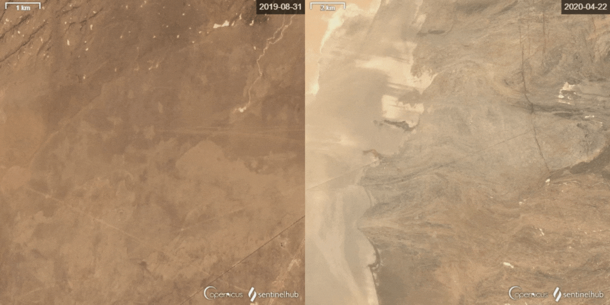
China is expanding its military facilities in the Lop Nur desert.
Since late 2019, China is building two probable military bases in Ruoqiang County, in the northwest of the country.

Benjamin PittetJan 91
This article is not a thorough analysis or an OSINT investigation, but rather a collection of my findings. I have been following Chinese military activity in the Lop Nur desert since 2020, although I am not an expert on the Chinese military. I am writing this article in the hope that someone with more expertise may be able to provide answers to some of my questions. Please keep in mind that I am not a Chinese military expert as you read.
Since late 2019, China is building two probable military bases in Ruoqiang County, in the northwest of the country. The two very similar sites are located not far from the Hami missile silo field, a mysterious military airfield and the Lop Nur Phosphate and Potash Mine.
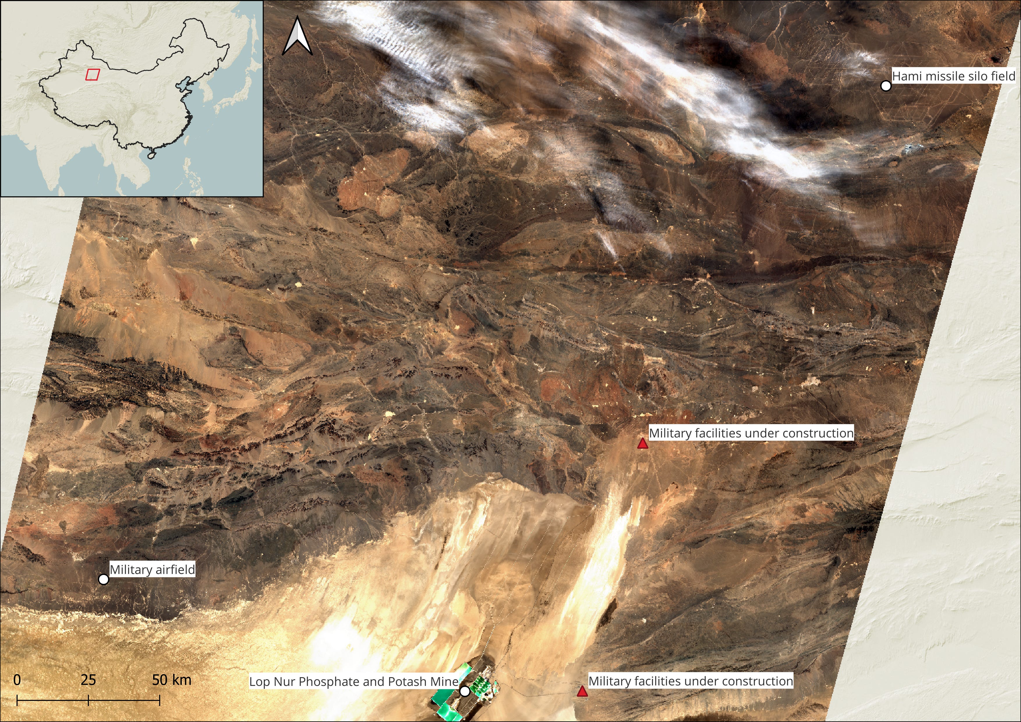
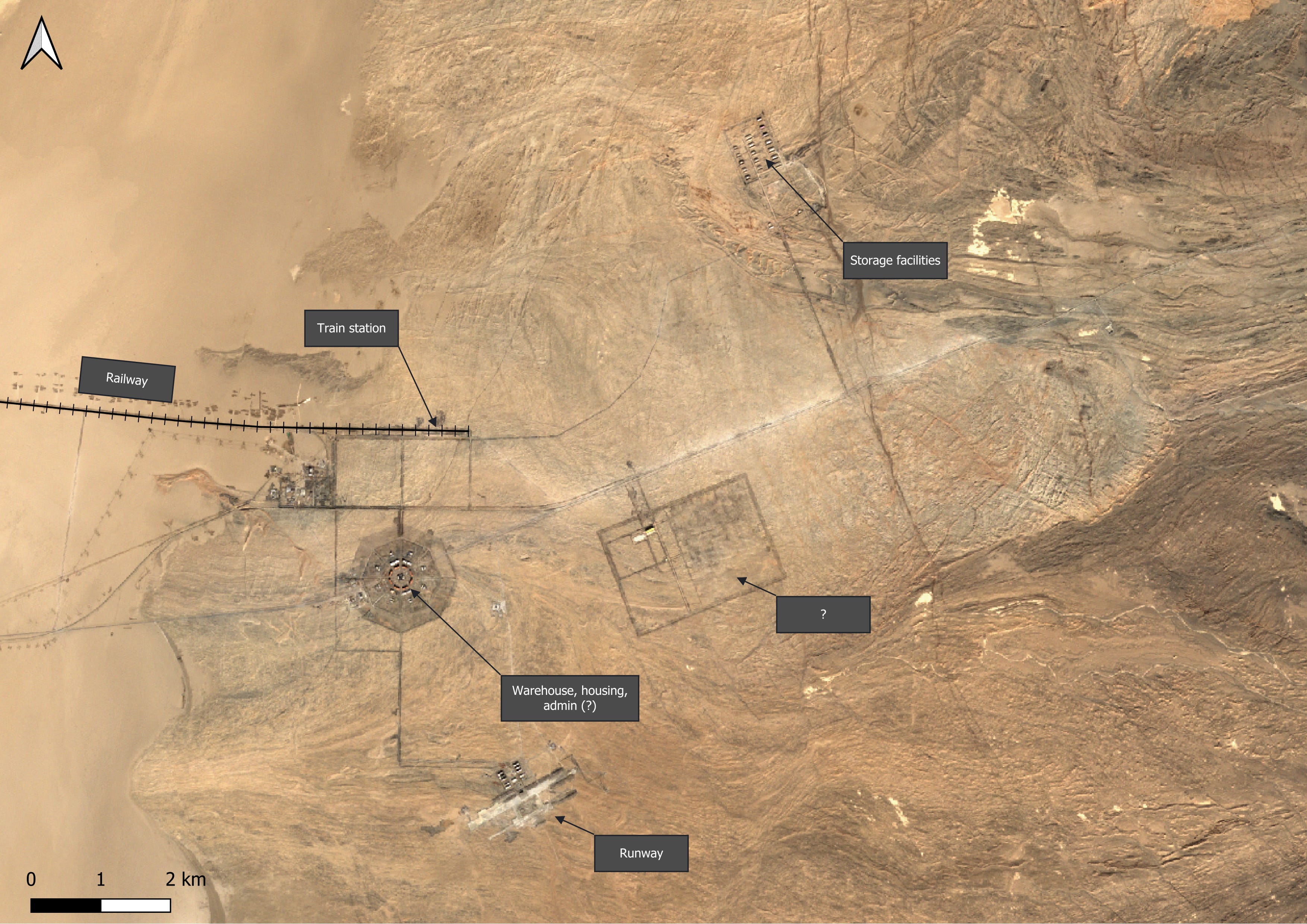
The northern facilities.
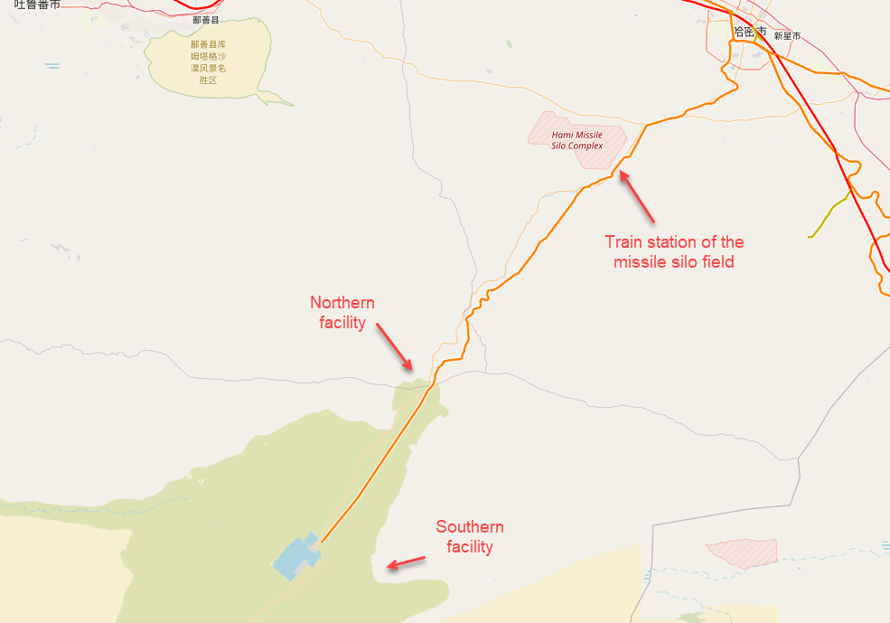
The northern facilities, which are situated approximately 90 kilometers away from the southern site and 140 kilometers from the Hami missile silo field, encompass a total area of over 50 square kilometers.
41°12’27.9″N 91°30’10.4″E
The facilities include a heliport, storage area, railway station, and an installation with three layers of buildings arranged in an octagonal shape with a central structure in the middle. I am unsure of the purpose of this installation or why it is designed in this unconventional shape.
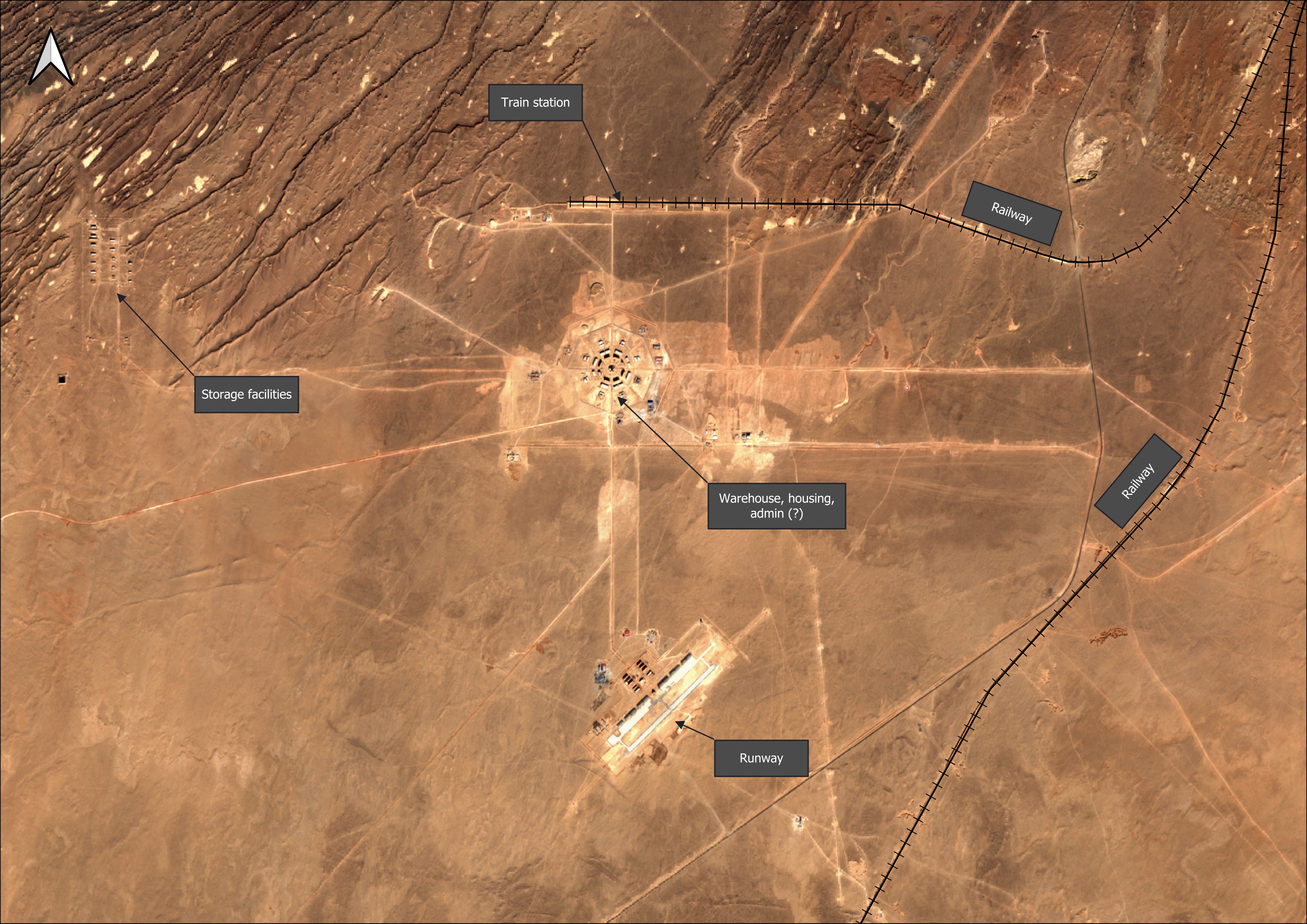
The railway station at the facility will be connected to the existing railway line between the Lop Nur phosphate and potash mine and the town of Hami. This railway line also leads to the Hami missile silo field, where a railway station is currently under construction.
In addition, the site features FOL depots, which usually store Fuel Oil and Lubricants, these will help the rail movements and other transportation in the zone to function seamlessly while enhancing connectivity.
The outline of the heliport first became visible on low-resolution satellite images in December 2020. Since then, numerous hangars, barracks, support buildings, and a 1.6 kilometer runway have emerged in the desert. Construction has continued at a steady pace and is still ongoing as of January 2023.
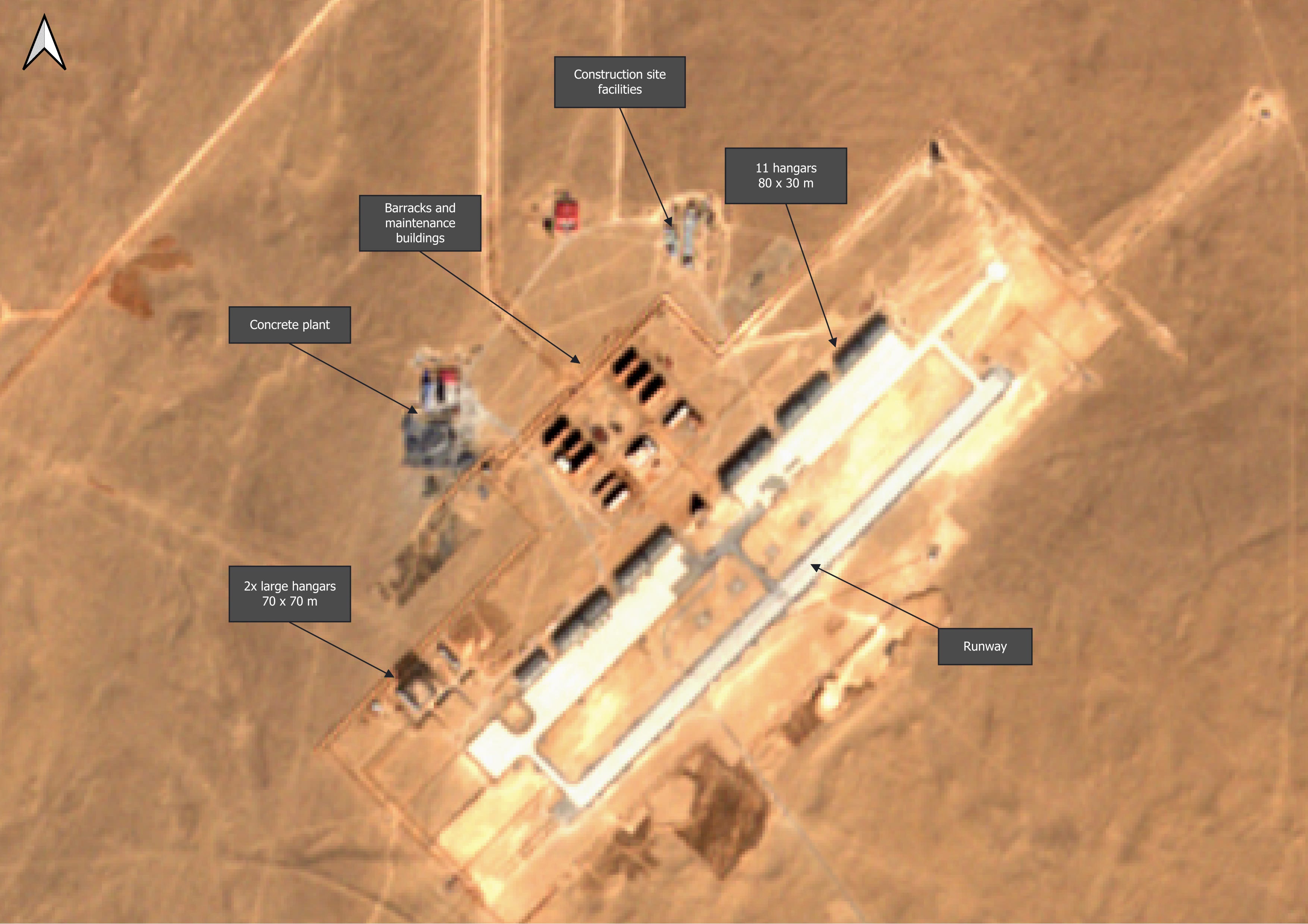
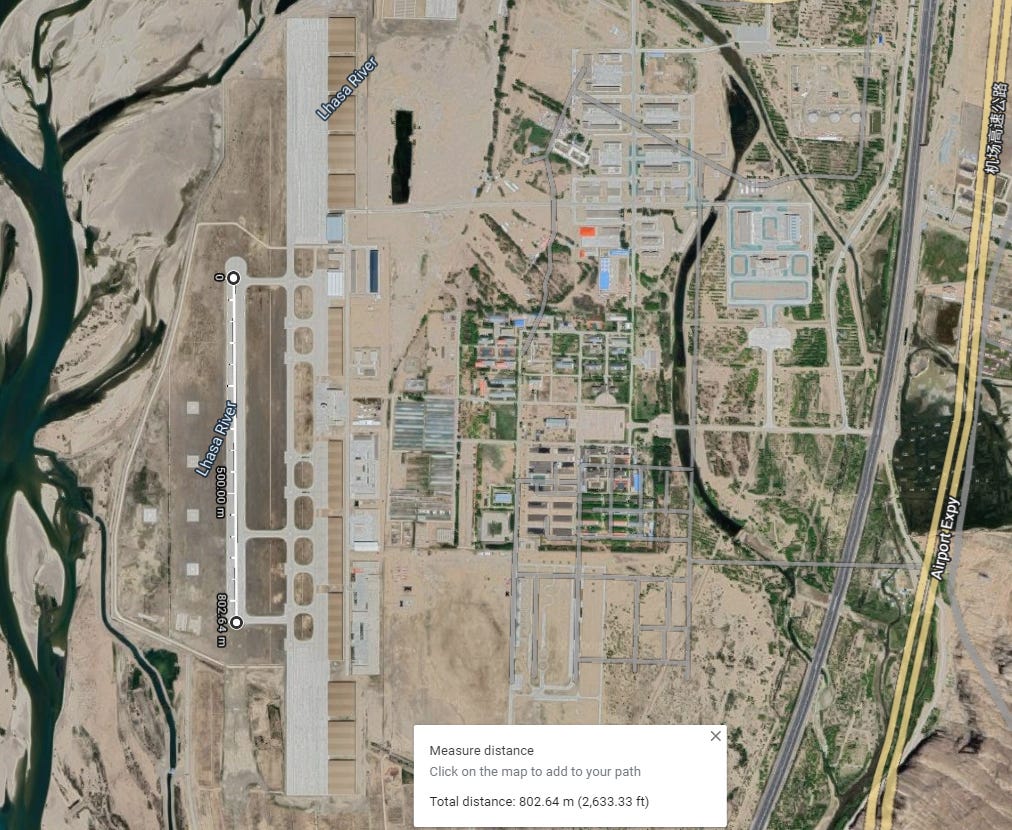
The 1.6 kilometre runway surprises me. Other heliport runways I have measured are usually half that length and airport runways are usually much longer than 1.6 kilometres. I would be grateful if someone could provide me with some clarification on this point.
The octagonal facility includes buildings and warehouses arranged in three layers. In the center is a building that I assume will serve an administrative function.
I am very puzzled by this site!
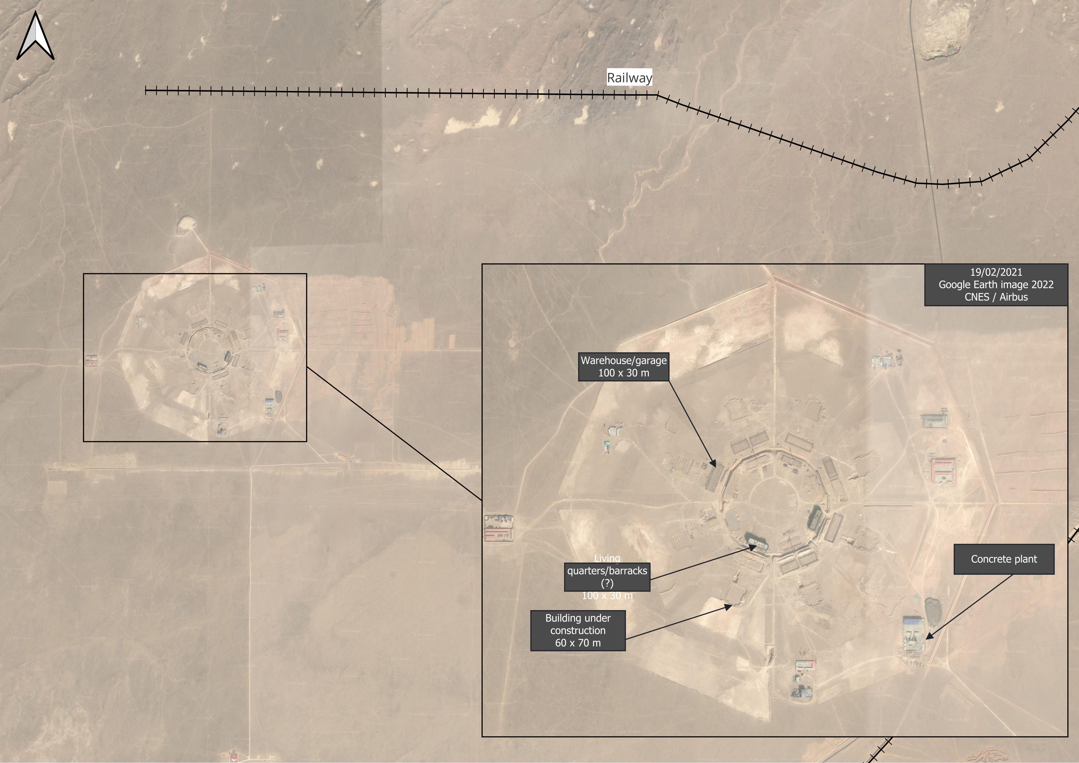
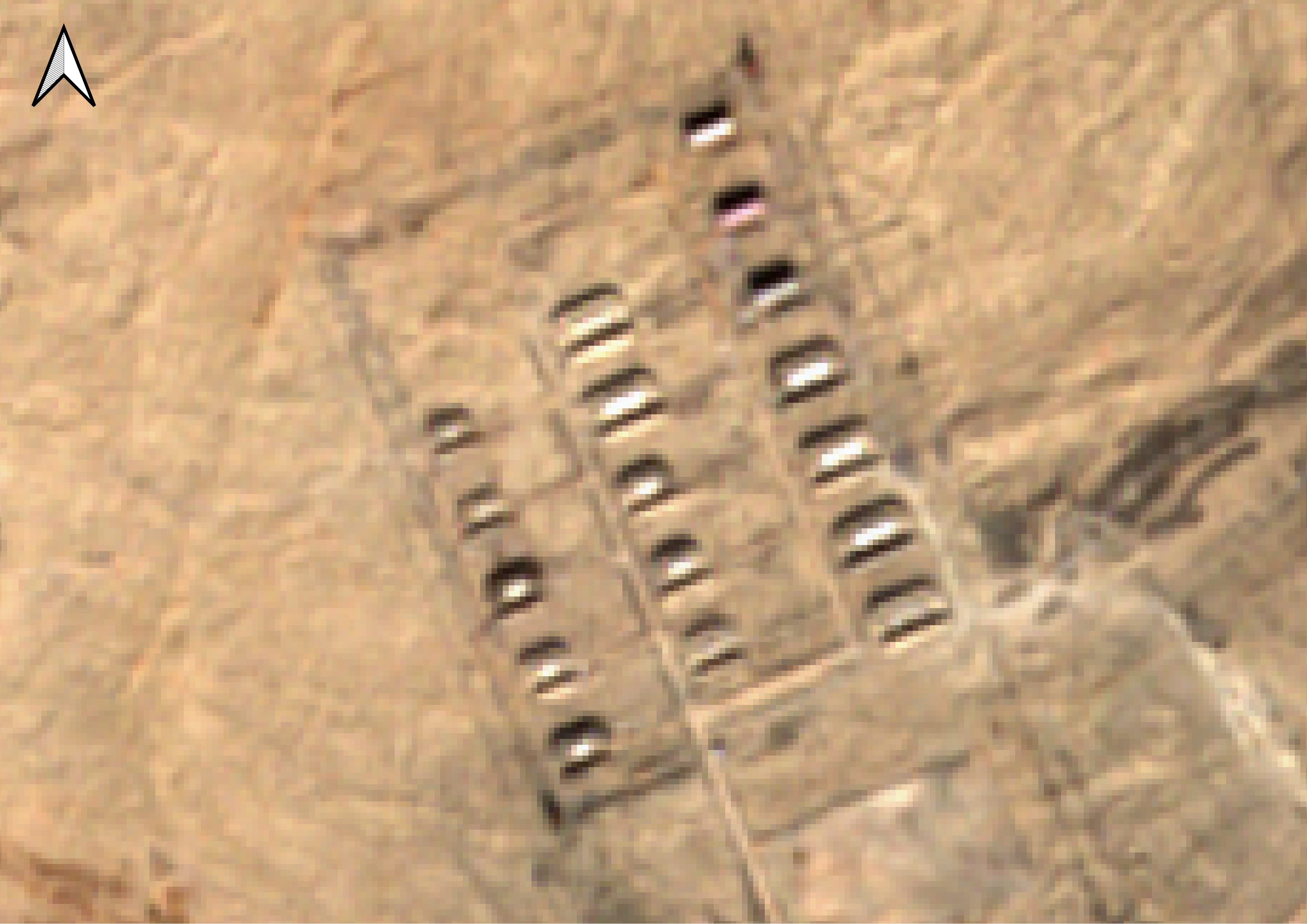
The independent storage sites at the north and south facilities are of particular interest. Both storage sites are located away from other facilities and consist of hardened shelters.
At the northern facilities, a possible water pit for fire emergencies located at 41.2250, 91.41451 which reinforces an explosives or munitions storage hypothesis. In addition, the presence of a guard tower at 41.24297, 91.41827 further indicates the facility is a high security zone, once again backing the probability of this site being a sensitive, military area.
The storage facility on the northern site is currently under construction. To better understand what the finished site might look like, we can examine the storage facility at the southern facilities at 40.48290, 91.31334. As mentioned earlier, two similar facilities are being built. Looking at the complex, we can see that the storage warehouses are surrounded by protective berms which are usually used to contain an internal explosion or protect from external attacks, this leads us to believe the site could potentially be used for storing sensitive munitions or other explosive material.
The southern facilities.
40°25’41.9″N 91°15’07.0″E
The southern facilities are quite similar to those in the north. A railroad was built to connect the southern facilities to the mine, the northern facilities, and the missile silos. Another zone that began construction at the same time as the main facility is seen at 40.4328, 91.2978 , purpose of this site is unknown at the time, but appears to be linked to the overall development happening in the sector
In conclusion, it appears that China is constructing two potential military bases in Ruoqiang County in the northwest region of the country. The exact purpose of these facilities is not clear to me, but their proximity to other military infrastructure, including the Hami missile silo field, makes them, in my opinion, particularly noteworthy. Additionally, the two facilities are connected by a rail link.
I would welcome any additional information or insights on this matter.
Thank you for taking the time to read my analysis. If you found it informative and insightful, please consider subscribing to my Substack newsletter.
This article has been updated with inputs from Damien Symon (@detresfa_).
Subscribe to Benjamin’s Newsletter
By Benjamin Pittet · Launched 2 days ago
OSINT InvestigationsSubscribeLike
1 likeCommentsTopNewChaplynka 2.0New heliport construction in Berdyansk highlights the urgent need for Ukraine to acquire longer-range strike capabilities to counter Russian invasion.BENJAMIN PITTET19 HR AGO
Ready for more?
Subscribe© 2023 Benjamin PittetPrivacy ∙ Terms ∙ Collection noticePublish on SubstackGet the appSubstack is the home for great writing