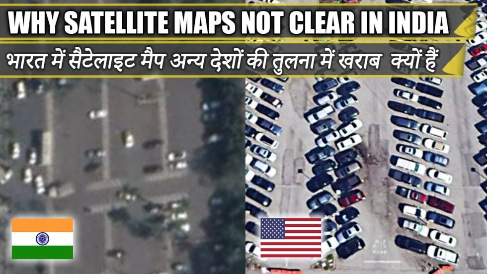
Why does India’s satellite view on Google maps show so blurry as compared to satellite views of developed nations like the US, the UK and Australia? Is it the weather/pollution or do they use low quality imaging systems for developing countries like India